


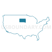
Lakota Region PUMA, South Dakota
About
Outline

Summary
| Unique Area Identifier | 193969 |
| Name | Lakota Region PUMA |
| State | South Dakota |
| Area (square miles) | 29,622.71 |
| Land Area (square miles) | 28,983.51 |
| Water Area (square miles) | 639.20 |
| % of Land Area | 97.84 |
| % of Water Area | 2.16 |
| Latitude of the Internal Point | 44.09514240 |
| Longtitude of the Internal Point | -100.91918770 |
Maps

Graphs
Select a template below for downloading or customizing gragh for Lakota Region PUMA, South Dakota


Neighbors
Neighoring Public Use Microdata Area (by Name) Neighboring Public Use Microdata Area on the Map
- Campbell, Goshen, Platte, Johnson, Washakie, Weston, Crook & Niobrara Counties PUMA, WY
- Jackrabbit Region PUMA, SD
- North Central & Northwest Nebraska PUMA, NE
- Northeast Nebraska PUMA, NE
- Northeast South Dakota PUMA, SD
- South Central North Dakota--Bismarck City PUMA, ND
- West North Dakota--Minot City PUMA, ND
- West South Dakota--Rapid City PUMA, SD
Top 10 Neighboring County (by Population) Neighboring County on the Map
- Pennington County, SD (100,948)
- Meade County, SD (25,434)
- Hughes County, SD (17,022)
- Shannon County, SD (13,586)
- Todd County, SD (9,612)
- Dawes County, NE (9,182)
- Charles Mix County, SD (9,129)
- Knox County, NE (8,701)
- Custer County, SD (8,216)
- Hutchinson County, SD (7,343)
Top 10 Neighboring County Subdivision (by Population) Neighboring County Subdivision on the Map
- Pierre city, Hughes County, SD (13,646)
- West Shannon UT, Shannon County, SD (8,153)
- East Shannon UT, Shannon County, SD (5,325)
- West Todd UT, Todd County, SD (4,863)
- West Custer UT, Custer County, SD (3,735)
- Hot Springs city, Fall River County, SD (3,711)
- North Dewey UT, Dewey County, SD (3,228)
- Winner city, Tripp County, SD (2,897)
- East Todd UT, Todd County, SD (2,858)
- West Hughes UT, Hughes County, SD (2,437)
Top 10 Neighboring Place (by Population) Neighboring Place on the Map
- Pierre city, SD (13,646)
- Hot Springs city, SD (3,711)
- Pine Ridge CDP, SD (3,308)
- Winner city, SD (2,897)
- Chamberlain city, SD (2,387)
- Fort Pierre city, SD (2,078)
- North Eagle Butte CDP, SD (1,954)
- Rosebud CDP, SD (1,587)
- Wagner city, SD (1,566)
- Eagle Butte city, SD (1,318)
Top 10 Neighboring Elementary School District (by Population) Neighboring Elementary School District on the Map
Top 10 Neighboring Unified School District (by Population) Neighboring Unified School District on the Map
- Meade School District 46-1, SD (18,211)
- Pierre School District 32-2, SD (16,064)
- Shannon County School District 65-1, SD (13,586)
- Todd County School District 66-1, SD (9,612)
- Custer School District 16-1, SD (7,983)
- Chadron Public Schools, NE (7,545)
- Chamberlain School District 07-1, SD (6,044)
- Hot Springs School District 23-2, SD (5,954)
- Eagle Butte School District 20-1, SD (4,830)
- Winner School District 59-2, SD (4,660)
Top 10 Neighboring State Legislative District Lower Chamber (by Population) Neighboring State Legislative District Lower Chamber on the Map
- State House District 29, SD (25,322)
- State House District 30, SD (24,446)
- State House District 20, SD (22,214)
- State House District 27, SD (21,985)
- State House District 24, SD (21,361)
- State House District 22, SD (21,252)
- State House District 21, SD (21,057)
- State House District 19, SD (19,075)
- State House District 23, SD (18,409)
- State House District 31, ND (13,907)
Top 10 Neighboring State Legislative District Upper Chamber (by Population) Neighboring State Legislative District Upper Chamber on the Map
- State Senate District 40, NE (31,744)
- State Senate District 49, NE (31,705)
- State Senate District 43, NE (31,106)
- State Senate District 29, SD (25,322)
- State Senate District 30, SD (24,446)
- State Senate District 20, SD (22,214)
- State Senate District 27, SD (21,985)
- State Senate District 26, SD (21,575)
- State Senate District 24, SD (21,361)
- State Senate District 22, SD (21,252)
Top 10 Neighboring 111th Congressional District (by Population) Neighboring 111th Congressional District on the Map
- Congressional District (at Large), SD (814,180)
- Congressional District (at Large), ND (672,591)
- Congressional District (at Large), WY (563,626)
- Congressional District 3, NE (561,378)
Top 10 Neighboring Census Tract (by Population) Neighboring Census Tract on the Map
- Census Tract 116, Pennington County, SD (6,720)
- Census Tract 9651, Custer County, SD (5,525)
- Census Tract 9777, Hughes County, SD (5,447)
- Census Tract 9778, Hughes County, SD (5,419)
- Census Tract 9402, Todd County, SD (5,161)
- Census Tract 9408, Shannon County, SD (4,745)
- Census Tract 9401, Todd County, SD (4,451)
- Census Tract 9409, Shannon County, SD (4,422)
- Census Tract 9405, Shannon County, SD (4,419)
- Census Tract 205, Meade County, SD (4,380)
Top 10 Neighboring 5-Digit ZIP Code Tabulation Area (by Population) Neighboring 5-Digit ZIP Code Tabulation Area on the Map
- 57501, SD (16,309)
- 69337, NE (7,365)
- 57747, SD (5,870)
- 82701, WY (5,455)
- 57730, SD (5,315)
- 57770, SD (5,271)
- 57580, SD (4,449)
- 57625, SD (4,230)
- 69201, NE (4,005)
- 57601, SD (4,003)